The Stratospheric Observatory at Eureka
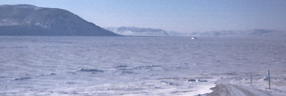
Now, the real reason why I visited Eureka was not to study the wildlife, but rather to study the atmosphere. To do so, each day I traveled up "Big Jim Norman Road", which winds along Slidre Fjord and then 600 m up a mountain ridge to where Eureka's stratospheric observatory is perched. The flat area in the picture at left is the fjord, which freezes up to 2 m thick during the winter. That's Hare Cape in the top left corner, and Axel Heiberg Island in the distance. Note the iceberg frozen into the fjord.
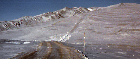
As you can see, the terrain is quite rugged. We employ a heavy duty truck to navigate this often hazardous road. You may also have noticed that there doesn't seem to be very much snow in many of these pictures. That is because the Canadian High Arctic is actually a very cold desert, receiving very little precipitation each year.
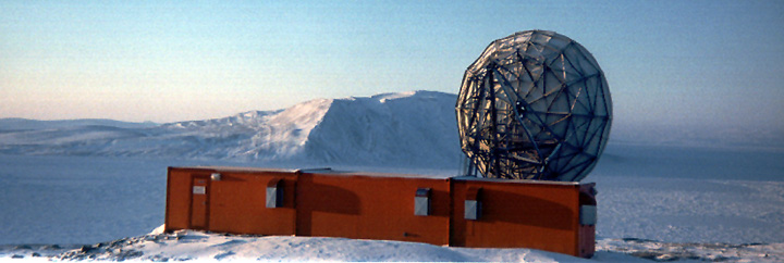
Along the way to the stratosperic observatory, we pass by the satellite dish pictured below, which is our only connection to the rest of the planet. It is pointed horizontally because the communication satellites are all on the horizon, rather than overhead (as is usual).
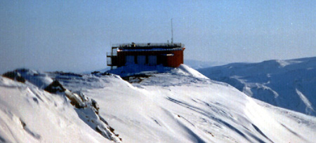
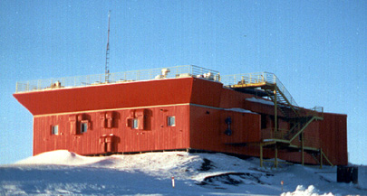
Finally, the Eureka stratospheric observatory: this is a state of the art facility, housing two lidars, a Brewer spectometer, an FTIR, and an all sky camera, amongst other instruments.
Studies at Eureka have been extremely fruitful. During the winter, there is very little cloud cover, and so useful observations are possible on about 80% of the nights (which is extraordinary in comparison to other observatories).